10 Long Island hiking trails to try this season on Long Island
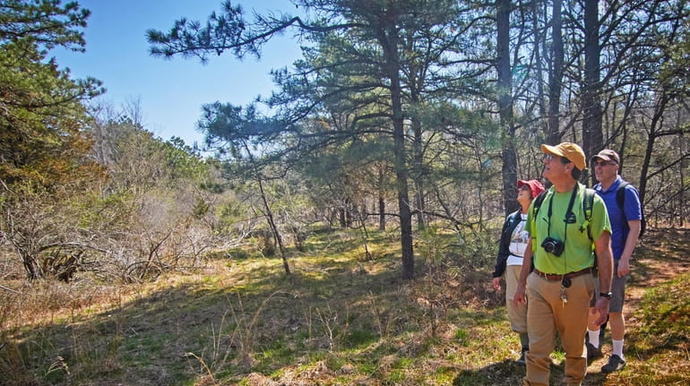
Here are hiking paths on Long Island to try this season. Credit: Ed Betz
On Long Island, there are thousands of miles of trails through woods, fields and sand. Many of them are suitable for kids, and some even have guided tours. Take a look at some of the best hiking trails in Nassau and Suffolk.
FIRE ISLAND WILDERNESS, Hike from east or west to the wilderness breach in the only federally designated wilderness in New York State and experience beautiful undeveloped barrier island beaches. Three-mile round-trip hike to wilderness breach via Wilderness Visitor Center adjacent to Smith Point County Park, accessible by car year-round. Or 10-mile hike on wilderness path and beach to wilderness breach, accessible via ferry to Watch Hill and points west to Fire Island. More information at nps.gov/fiis or 631-687-4750.
LONG ISLAND GREENBELT TRAIL, 32 miles along the Connetquot and Nissequogue rivers. National Recreation Trail goes from Heckscher State Park on Great South Bay to Sunken Meadow bluffs on the Sound. Access at Connetquot River State Park Preserve on the south (Sunrise and Montauk highways), and on the north at Caleb Smith State Park Preserve, Jericho Turnpike between bull statue and Old Willets Path (preserve open 9 a.m.-4 p.m. Wed.-Sun.) and Nissequogue River State Park (St. Johnland Road). Other accesses at Heckscher State Park (field 7), Sunken Meadow State Park (field 3) and Blydenburgh County Park (New Mill Road).
LONG ISLAND PINE BARRENS TRAIL, nearly 50 miles of footpaths in eastern Suffolk. Meanders past swamps, ponds and overlooks from Rocky Point to Shinnecock Canal. Includes Rocky Point Preserve, Pine Trail Preserve, Peconic River watershed, Maple Swamp and Sears Bellows County Park. Hike this trail or park a vehicle; contact the DEC, nwsdy.li/trailpermits. Other access at Pine Trail Preserve parking area on Route 25, a half-mile east of William Floyd Parkway. Trail is part of the 130-mile Paumanok Path that runs from Rocky Point to Shinnecock Canal, has a few links in Southampton and leads from East Hampton border to Montauk Point. See ligreenbelt.org for more details. For special events, see pb.state.ny.us.
MASHOMACK PRESERVE HIKING TRAIL, 1½ to 10-mile loops wind through the 2,039-acre preserve’s oak-hickory forest, across open meadows and beside freshwater ponds and salt marshes. One-mile wheelchair and stroller-friendly trail and 1⁄8-mile Braille boardwalk also available. Restrooms are closed due to COVID restrictions. See nwsdy.li/mashomack for trail map; Parking at Visitor Center, 79 South Ferry Rd., Shelter Island, 631-749-4219.
NASSAU-SUFFOLK TRAIL, 20 miles between Massapequa Preserve and Cold Spring Harbor. South entrance on Ocean Avenue, north of Merrick Road. Trail follows the shore of Caroon’s Lake to a log bridge, where vegetation begins to change to pine barrens. North of the preserve, the trail parallels Bethpage Parkway. Additional access from west side of picnic area parking lot in Bethpage State Park and Trail View State Park parking areas north of Old Country Road and Washington Avenue. The hilly north section ends at Cold Spring Harbor State Park on Route 25A. Stretch of Nassau-Suffolk Trail between Stillwell Woods in Syosset and Route 25A in Cold Spring Harbor has trees not in the pine barrens. It ends at a Greenbelt parking area near Cold Spring Harbor library on Route 25A.
NORTHWEST PATH, 6- to 7-mile path in East Hampton Town, includes a section of Paumanok Path (125-mile path from Rocky Point to Montauk), which winds through oak and hickory forest where understory is mostly lowbush blueberry and black huckleberry. Immense white pine groves may be traversed through the Chatfield’s Hole and Grace Estate properties. Trail’s end at Cedar Point boasts wetlands with foliage and bird life. Deer and red-tailed hawks are frequently seen. Start at Route 114 at Edwards Hole Nature Preserve. Park in the parking lot at 114. Northwest Path is blazed with yellow triangles.
RAY CORWIN TRAIL, 12.4 miles from NY 25A in Rocky Point preserve to downtown Yaphank, passing through DEC, Suffolk County and town of Brookhaven land east of the Carman’s River Accesses at Rocky Point, a DEC parking lot on NY 25, and East Main Street in Yaphank.
RED CREEK PARK, a 3.8-mile loop in Red Creek Town Park, Hampton Bays. Red-tailed hawk, blue heron, kettle holes, deer and, in October, monarch butterflies. Trail winds through pitch pine woods mixed with oak, maple and tupelo. A posted trail map is available in the park on Old Riverhead Road (off Route 24) in Hampton Bays. Parking areas open to all.
STUMP POND TRAIL, 5 ¾-mile trail begins at the Long Island Greenbelt Trail Conference office at the north side of Blydenburgh County Park (New Mill Road) in Smithtown, and winds around 164-acre Stump Pond. Tours of historic area will resume after the COVID restrictions are lifted, ligreenbelt.org for more information.
WALT WHITMAN TRAIL, a 3.8-mile loop with a total of 8 miles of trails from the Whitman home through West Hills County Park, Huntington. Circular trail includes Jaynes Hill, the highest point on Long Island. Trail links with Nassau-Suffolk Trail. Park at county park entrance off Sweet Hollow Road. Parking also near Jaynes Hill on Reservoir Road.