Northern Nassau, Suffolk drenched by heavy rains

Kevin Guan and Melissa Ramnath, both of Brooklyn, were prepared with an umbrella when an afternoon shower moved over the Lavender by the Bay fields in East Marion on Saturday. Credit: Newsday/John Paraskevas
The National Weather Service canceled a flood advisory across the Island on Saturday after heavy rains moved through parts of northern Nassau and Suffolk counties.
Those downpours passed over parts of north-central Suffolk County, including Huntington, Commack and Smithtown.
Between 1½ and 2 inches of rain fell, but it had largely tapered off by 1:30 p.m. when the flood advisory expired. Meteorologists had said additional storms could continue through Saturday afternoon.
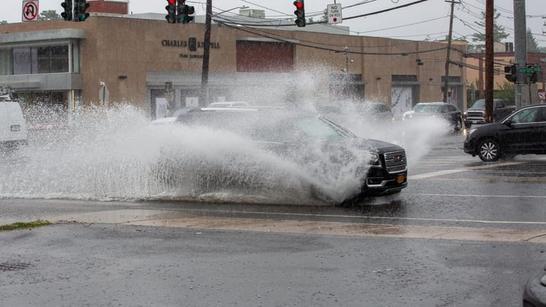
Cars and trucks splash though the puddles left by a downpour at the corner of Northern Blvd. and Glen Cove Rd. in Greenvale. Credit: Linda Rosier
A tree was reported down across Depot Road and East 11th Street in Huntington Station at 1:50 p.m., Suffolk police said. No one was injured.
Otherwise, no storm damage or major flooding was reported, according to authorities.
Saturday night there was a slight chance of showers and thunderstorms between 10 p.m. and midnight, and a slight chance of showers after midnight.
Sunday on Long Island will be partly sunny with another slight chance of showers in the afternoon and a high temperature of about 81 degrees in Islip, according to the weather service. The chance of precipitation was pegged at 20%.
Showers and thunderstorms are considered likely Monday, mainly after 2 p.m., with a high temperature near 80 degrees.
Temperatures are then expected to rise into the high 80s from Tuesday through Friday, with another slight chance of showers and thunderstorms in the forecast for Thursday night.

John Asbury is a breaking news and general assignment reporter. He has been with Newsday since 2014 and previously worked at The Press-Enterprise in Riverside, California.