Nor'easter to bring 7 inches of snow as coastal flood warning is issued
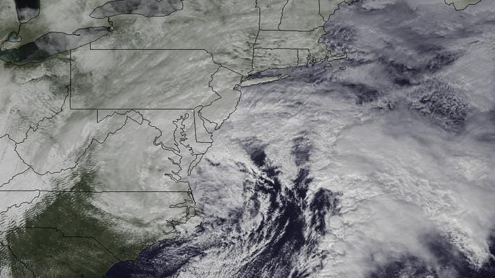
A late-winter storm impacts the mid-Atlantic before delivering more snow to parts of the Northeast. (March 6, 2013) Credit: NASA/NOAA
A two-phase attack of the weather was bringing high winds and coastal flooding overnight into Thursday, as up to 7 inches of snow was expected to accumulate by Friday afternoon, the National Weather Service said.
Light rain fell on and off Wednesday until about 9 p.m., when snowfall was reported, the service said. Wind gusts hit 56 mph off Lido Beach and 51 mph off Captree State Park, the service said.
High winds were expected to down power lines, and that's what happened soon after the storm turned to mostly snow.
By 12:50 a.m. Thursday, nearly 500 customers had no power, the Long Island Power authority's outage map showed.
Strong winds were reported all day under a wind advisory forecasting gusts of up to 50 mph, the service's Upton office said.
By Wednesday night, gusts of 56 mph were reported off Lido Beach and 51 mph off Captree State Park, the service said. The wind advisory is in effect until 6 p.m. Thursday.
Long Island officials and meteorologists were also on the watch overnight for coastal flooding. The weather service had upgraded its coastal flood forecast Wednesday from watch to warning, in effect until 9 a.m. Thursday.
Water levels were expected to rise 2.5 to 3.5 feet above normal at high tide and waves were expected to crest at 15 feet in the Atlantic Ocean, causing beach erosion.
At the same time, meteorologists downgraded the snow forecast from warning to advisory.
"We're not calling for anything like the blizzard -- nowhere near it," said Joe Picca, a weather service meteorologist in Upton, referring to the early February storm that paralyzed the region.
The storm was expected to leave 1 to 2 inches across most of Long Island and up to 3 inches on the East End by the time people head to work Thursday, Picca said.
Snowfall will come and go Thursday before a second wave hits overnight into Friday, dumping an additional 2 to 4 inches across the Island before tapering off in the daytime, according to the forecast.
Picca said the snow, along with gusts up to 55 mph, had the potential to crack tree limbs and down power lines.
Agencies, from state transportation to town public works departments, said they were ready to avoid a repeat of last month's blizzard response, when even snow plows got stuck and some Brookhaven Town roads remained impassable for four days.
State transportation officials said their crews on Long Island have been prepping 229 plow trucks and heavy-duty loaders, including 12 large snow plows that arrived from upstate Wednesday morning.
After last month's blizzard, it took heavy-duty equipment, such as front-end loaders, to clear the Long Island Expressway so that lighter snow plows could get in, paving the way for tow trucks to clear out abandoned cars.
In Islip Town, for example, Supervisor Tom Croci said crews were preparing Wednesday night for a two-punch attack of the weather.
"We're ready for two waves of storm," he said. "One is the high wind and water, and the second is the snow and high wind."
Two 18-wheeler tanker trucks and smaller vehicles were positioned to pump out water from repeat-flood areas, such as Oakdale, West Islip, Sayville and other areas still recovering from Sandy, he said. The water will be released into bays or canals, he said.
Then if snow begins to accumulate past an inch or two, sand trucks and snow plows stationed across Islip will go to work around the clock, Croci said.
The service said the winter weather advisory expires noon Friday, with the precipitation tapering off by afternoon. By Saturday, most of Long Island can expect sunny skies with temperatures in the mid-40s.
"If people are having flashbacks of our previous blizzard, we're not forecasting anything of that nature," Picca said. "But we don't want to downplay this event. It has the potential to cause some significant impact."
Here are additional outlooks and updates:
Closures / cancellations
Wednesday evening activities have been canceled at a number of schools, including those in the Massapequa, Freeport, Southampton and Miller Place school districts.
Airports
As of mid evening Wednesday, flight arrivals into LaGuardia Airport were averaging delays of 21/2 hours, according the Federal Aviation Administration website. Some departures were also affected and the FAA advised travelers to check with their airlines. Kennedy Airport arrivals were averaging 15-minute delays.
LIPA
As for potential power outages, sustained winds are the main concern, said Wendy Ladd, spokeswoman for National Grid, which is working closely with LIPA and leading storm communications. When a storm "rolls in and rolls out," outages occur and are resolved, she said, but longer-term winds can result in repeat outages.
As part of a storm-response plan, an extra 160 line workers and some tree trimmers are moving into place Wednesday, bringing the total workforce to 400, Ladd said. Included are local contract workers and those being brought in from Connecticut and Pennsylvania, she said.
Coastal flooding
Minor to moderate coastal flooding can be expected along Long Island Sound, North Shore bays, Atlantic-facing beaches and bays during Wednesday evening and Thursday morning high tide cycles, the weather service said.
With Ellen Yan